- Producers of typical products
- Forum
- Environmental Education
- The Authorities
- Organization and Offices
- Council Notice Board
- Transparent Administration
- Reference Legislation
- Regulations in force
- The plan of the Park
- Consultation of deliberative acts


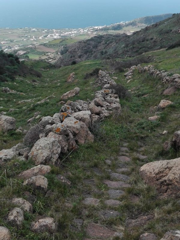
Trail No. 975: mountain trail - unpaved road
Hiking difficulty E
Length 5,2 km
Duration 2 hours and a half
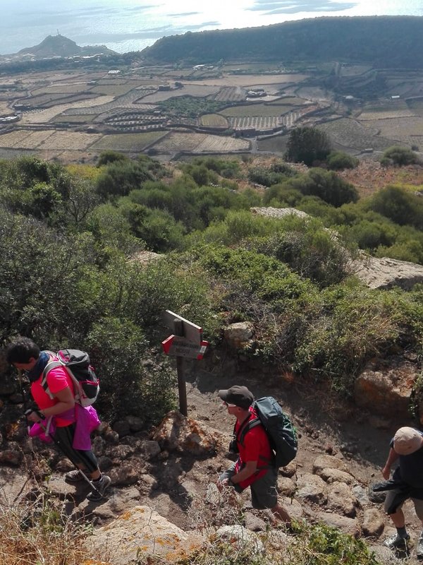
Trail No. 977: unpaved road - easy road
Length 3,2 km
Duration 1 hour
The theme of this trail is mainly naturalistic-forestry even if you cross rural areas, characterized by the typical agrarian architecture of the island, with a high vocation to the cultivation of zibibbo, olive and caper. The starting point coincides with the archaeological site of the Byzantine tombs carved into the volcanic rock.
 Download KMZ
 The itinerary consists of the path no. 5 and no. 7, from the coast of Zighidì you go down through a short stretch of forest path, until you arrive inside the Valle del Monastero, depression at the base of the primitive caldera that gave rise to the Pantelleria Island. The Valley of the Monastery is characterized by a strong rural value, since favorable soil and climatic conditions have led to the development of a thriving quality viticulture. The grape variety grown is Moscato d'Alessandria, commonly called "Zibibbo". The excursion continues north-east, through a path that climbs on the opposite side to that of departure, until you get to the Cave of "Bagno Asciutto". The fumes of water vapour, the result of secondary volcanic activity, allow you to take advantage of a natural Turkish bath. The entrance to the cave is covered with particular clusters of bryophytes, characterized by different endemic entities, rare or of particular phytogeographic interest.
The path then continues on the left, along the path that runs along the Passo del Vento, immersing itself in a landscape characterized by wild nature, which has fully colonized the lava flows, in particular after the abandonment of crops. The area is dominated by inaccessible slopes, denoting the remains of aspects of rural life and the remains of agricultural crops. There are sometimes expressions of indigenous forest vegetation, of great naturalistic value, belonging to the series of holm oak vegetation. The vegetation colonizes the large volcanic boulders with various aspects of scrub and low holm oak that play a pioneering role in the recolonization of the substrates.
In addition to the Holm oak, the floristic composition of this series of vegetation is characterized by evergreen thermo-xerophilous plants, such as the Strawberry tree (Arbutus unedo), the Erica arborea, the Pistacia lentiscus, the Smilax aspera and, the common hellebore (Phillyrea latifolia).
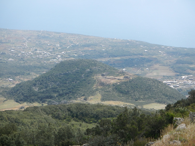
Further on, along the stretches of the volcanic cone of Fossa del Russo, the forest formation refers to the scrub-scrubland with Phoenician juniper, located on even poorer substrates and with greater sun exposure. The floristic composition differs from the previous one in the presence of the Periploca minor (Periploca angustifolia), the tree spurge (Euphorbia dendroides) and other thermophilic sclerophylls, among which we remember the Olive (Olea europea var. Silvestris), the Phillyrea angustifolia, the spiny broom (Calicotome villosa) etc.
The path, winding through these realities, passes on the edge of Fossa del Russo, overlooking the underlying plateau of the "Favare". The visitor at this point finds himself suspended between time and space, in a place where the earth seems to breathe; after a moment of amazement you will begin to descend towards the fumaroles, where the hearing is busy perceiving the rattle of the volcano, while touch makes you experience the warmth of the rocks of the most disparate colours, immersed in the fumes, with the characteristic sulphurous smell.
The "favare" are fumaroles whose gaseous component, mainly composed of water vapuor, also reaches temperatures of 50 °C.
Of particular interest are also, in this case, the cyanophytic stratifications, typical of thermal environments that develop near the emission vents. The peasants, in an ingenious way, transformed these vapours into a water resource, allocating heather branches over the spouts. Upon contact, the water vapour condensed and the water droplets were expertly conveyed through channels into tanks. Although the channels are partially abandoned, the phenomenon is still visible.
From this wonderful scenario you will start to return towards Monastero. The path flanks the bed of a small stream that accompanies you to the town of Rekale, where you would travel a short stretch of concrete road, re-entering the rural reality, until you reach the heart of Valle Monastero. Going up the calderic rim, the starting point of the excursion, you have an overview of the entire route. The profound considerations remain on the genesis of the island, as well as on the efforts and adaptations of the Pantelleria man, aimed at making a land so impervious and difficult productive, at a considerable distance between Sicily and Africa.